Topcon Suite


MAGNET is a powerful tool that helps you control your business and improve your profit. Plan, manage, and oversee your projects. Track and manage your assets. Simplify processes, and reduce chances for errors with 3D visualization. Topcon is a constant partner in providing you with the tools that suit your needs. Get productive today.

Magnet Field
MAGNET Field is a powerful and intuitive field application software that enables you to collect survey mapping data and perform construction and road layout using total stations, levels, and GNSS receivers.
MAGNET Field is easy to use. Perform topographic and layout operations with a supportive Microsoft Bing Maps satellite image background. Carry your custom CAD standards to the field with a single screen tap; the software will instantly draw three dimensional linework and symbols.
Discover MAGNET Field features and benefits.
- Intuitive user interface
- Advanced roading tool set
- Vast library of Import / Export file formats
- Calculate, contour, and compare surfaces
- Surface staking with automatic Digital Terrain Model creation
- Colorized cut and fill indicators, as well as volume calculations
- Direct connectivity to your private Company Account for easy data exchange and quick chat
- Microsoft Bing Maps® for real-time images behind your points, lines, and imported design files
Magnet Field Layout
MAGNET Field Layout is a customized version of MAGNET Field data collection software that increases building layout productivity. With in-the-field plans and dimensional entry, you can go from paper plan or 3D model to building layout faster than ever.
Discover MAGNET Field Layout software features and benefits:
- Flexible building plan entry
- Intuitive and graphical building layout menus
- Large file format support including DWG
- Fast creation of design points from lines
- Hardware support for conventional and robotic total stations
- Exchange with MAGNET Enterprise, AutoCAD 360, or Bentley ProjectWise

Magnet Collage
MAGNET Collage provides data processing of otherwise disparate data sets into one 3D environment that can accommodate laser scanner, mobile scanning and mapping, road resurfacing scanners, and photogrammetric point clouds. To further simplify the combination of data, geographic coordinate points from ground control and surveying control can be leveraged for easy matching of point clouds.
- Combine Mobile and Static scan data into one immersive 3D environment.
- Faster point cloud processing and mass data handling
- Combine Civil, Mapping, BIM, and survey data
- Advanced matching and ground control functionality for a variety of sensors
- Extensive projections and geoids exports
- Segment and reduce point clouds to facilitate import into third-party software
- All in one mass data processing software
Point Manager
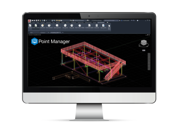
This plug-in for Autodesk Revit® and AutoCAD® provides you with a complete office-to-field workflow. Simplify the BIM-to-field process with automatic point creation and easily import and export layout files to and from a robotic total station. Import robotic total station field measurements and generate point reports, deviation reports, profiles, and surfaces. This improved digital layout workflow will increase your efficiency, accuracy and reduce risk.
- Reduce time and cost of construction layout
- Automatically create points on BIM objects
- Export background files and points to robotic total stations
- Import field points back into the original model
- Add coordinate systems that match the job site
- Compare points, perform QA/QC and generate advanced point comparison reports
